
Better Assessment Science Integrating Point and Non-point Sources (BASINS)
On this page:
Introduction
Better Assessment Science Integrating Point and Nonpoint Sources (BASINS) is a multipurpose environmental analysis system designed to help regional, state, and local agencies perform watershed- and water quality-based studies.
It was developed by the U.S. Environmental Protection Agency to assist in watershed management and TMDL development by integrating environmental data, analysis tools, and watershed and water quality models.
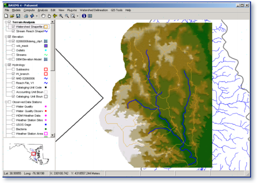
A geographic information system (GIS) provides the integrating framework for BASINS. GIS organizes spatial information so it can be displayed as maps, tables, or graphics. GIS allows the user to analyze landscape information and display relationships among data. Through the use of GIS, BASINS has the flexibility to display and integrate a wide range of information (e.g., land use, point source discharges, and water supply withdrawals) at a scale chosen by the user.
Why Use BASINS?
BASINS makes watershed and water quality studies easier by bringing together key data and analytical components in one tool. BASINS allows users to efficiently access national environmental information, incorporate local site-specific data, apply assessment and planning tools, and run a variety of proven, robust nonpoint loading and water quality models. BASINS is a useful tool for those interested in watershed management, development of total maximum daily loads (TMDLs), coastal zone management, nonpoint source programs, water quality modeling, and National Pollutant Discharge Elimination System (NDPES) permitting.
Contact Information
BASINS Listserv Community
Join the online BASINS Listserv community of users to exchange questions and answers regarding the use of BASINS.
- Email BASINS Listserv (lyris@lists.epa.gov):
Leave the "Subject:" field blank and add "subscribe basinsinfo firstname lastname" in the body of the text. Once you have subscribed, you will receive a welcome message confirming your membership.
The following email commands can be used to handle most end-user functions, instead of the web interface. View more information on email commands. (Browse to the "Email Commands" section in the navigation bar on the left side.)
- Contributing to a List:
Members can post to the list by sending their message to Basins Info (basinsinfo@lists.epa.gov). - Unsubscribe from a list:
Send an email message to Leave Basin Info (leave-basinsinfo@lists.epa.gov). - Search past list messages:
If you are a member of a mailing list, you can search past messages of the mailing list, and the messages that match your search specification will be sent back to you via email.
Send an email to the List Manager (listmanager@lists.epa.gov).
In the body of the message, use the command
search basinsinfo search words
Replace search words with the words you are searching for. ListManager will search for messages which contain any of the given search words. If multiple messages match your search, the search results will be organized so that the messages that matched more of your search terms appear at the top, and messages with equivalent search scores are organized with the newest messages first. - Contact List Owners (owner-basinsinfo@lists.epa.gov):
Mail sent to this address will be distributed to the owners of a mailing list.
BASINS Support Team
You can also contact EPA's BASINS Support Team (CEAM@epa.gov) to find additional information on BASINS not answered through the BASINS Listserv.
For questions about BASINS you may contact Glenn Fernandez (fernandez.glenn@epa.gov).
Citation
The preferred citation for BASINS is:
- US EPA (2019). BASINS 4.5 (Better Assessment Science Integrating point & Non-point Sources) Modeling Framework. National Exposure Research Laboratory, RTP, North Carolina. BASINS Core Manual. Accessed day month year.