U.S. flag

An official website of the United States government

Here’s how you know

Dot gov

Official websites use .gov
A .gov website belongs to an official government organization in the United States.

HTTPS

Secure .gov websites use HTTPS
A lock (LockA locked padlock) or https:// means you’ve safely connected to the .gov website. Share sensitive information only on official, secure websites.

Emergency

This is not the current EPA website. To navigate to the current EPA website, please go to www.epa.gov. This website is historical material reflecting the EPA website as it existed on January 19, 2025. This website is no longer updated and links to external websites and some internal pages may not work. More information »

    • Environmental Topics
    • Air
    • Bed Bugs
    • Cancer
    • Chemicals, Toxics, and Pesticide
    • Climate Change
    • Emergency Response
    • Environmental Information by Location
    • Environmental Justice
    • Greener Living
    • Health
    • Land, Waste, and Cleanup
    • Lead
    • Mold
    • Radon
    • Research
    • Science Topics
    • Water Topics
    • A-Z Topic Index
    • Laws & Regulations
    • By Business Sector
    • By Topic
    • Compliance
    • Enforcement
    • Laws and Executive Orders
    • Regulations
    • Report a Violation
    • Environmental Violations
    • Fraud, Waste or Abuse
    • About EPA
    • Our Mission and What We Do
    • Headquarters Offices
    • Regional Offices
    • Labs and Research Centers
    • Planning, Budget, and Results
    • Organization Chart
    • EPA History
    • Staff Directory

Breadcrumb

  1. Home
  2. USS Lead Superfund Site
  3. USS Lead Superfund Site
  4. Sampling Data Maps and Results Viewer

Cleanup Activities

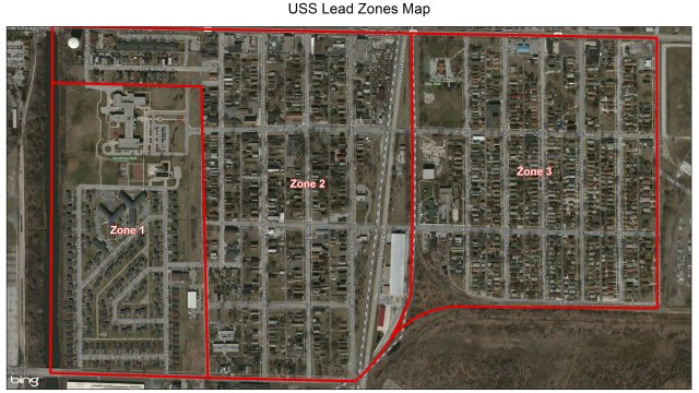
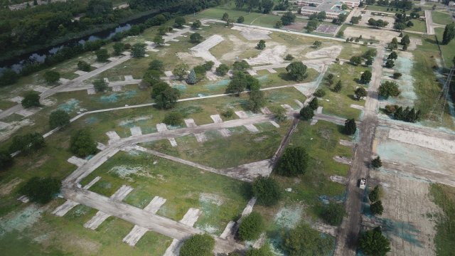
  • Operable Unit 1, Zone 1

    Carrie Gosch excavation work done in certain areas

    West Calumet Housing Complex was demolished in 2018.

    Learn about OU1: Zone 1
  • Operable Unit 1, Zone 2

    USS Lead Zones Map

    There are 597 properties in Zone 2.

    Learn about OU1: Zone 2
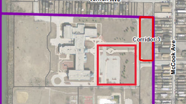
  • Operable Unit 1, Zone 3

    USS Lead Zones Map

    There are 481 properties in Zone 3.

    Learn about OU1: Zone 3
  • Operable Unit 2

    aerial view of uss lead

    Access to the land area of OU2 is restricted. 

    Learn about OU2

USS Lead Superfund Site

  • USS Lead Superfund Site
    • About the Site
    • Photo Gallery
    • Sampling Data Maps and Results Viewer
  • Public Outreach Documents
    • Technical and Legal Documents
    • NPL Partial Deletion Docket
    • Administrative Records
  • Cleanup Activities
    • OU1: Zone 1
    • OU1: Zone 2
    • OU1: Zone 3
    • OU2
Contact Us about the USS Lead Superfund Site
Contact Us about the USS Lead Superfund Site to ask a question, provide feedback, or report a problem.
Last updated on May 28, 2024
  • Assistance
  • Ayuda
  • Arabic
  • Chinese (simplified)
  • Chinese (traditional)
  • Aide
  • Asistans
  • Korean
  • Assistência
  • Russian
  • Tulong
  • Vietnamese
United States Environmental Protection Agency

Discover.

  • Accessibility Statement
  • Budget & Performance
  • Contracting
  • EPA www Web Snapshot
  • Grants
  • No FEAR Act Data
  • Plain Writing
  • Privacy
  • Privacy and Security Notice

Connect.

  • Data
  • Inspector General
  • Jobs
  • Newsroom
  • Regulations.gov
  • Subscribe
  • USA.gov
  • White House

Ask.

  • Contact EPA
  • EPA Disclaimers
  • Hotlines
  • FOIA Requests
  • Frequent Questions

Follow.